

Land & Agriculture
Horizon Lens LLC captures your land from a perspective only drones can achieve. Our high-resolution aerial imagery and detailed flyover videos help farmers, ranchers, and property developers monitor crops, assess property boundaries, and showcase acreage with precision and clarity.
From large-scale farmland to custom plots, our aerial photography provides actionable insights, supports planning decisions, and elevates marketing efforts for land sales or agricultural projects. Every shot is professionally captured and edited to reveal the full potential of your property.
See your land from above. Make informed decisions. Showcase every acre with clarity.
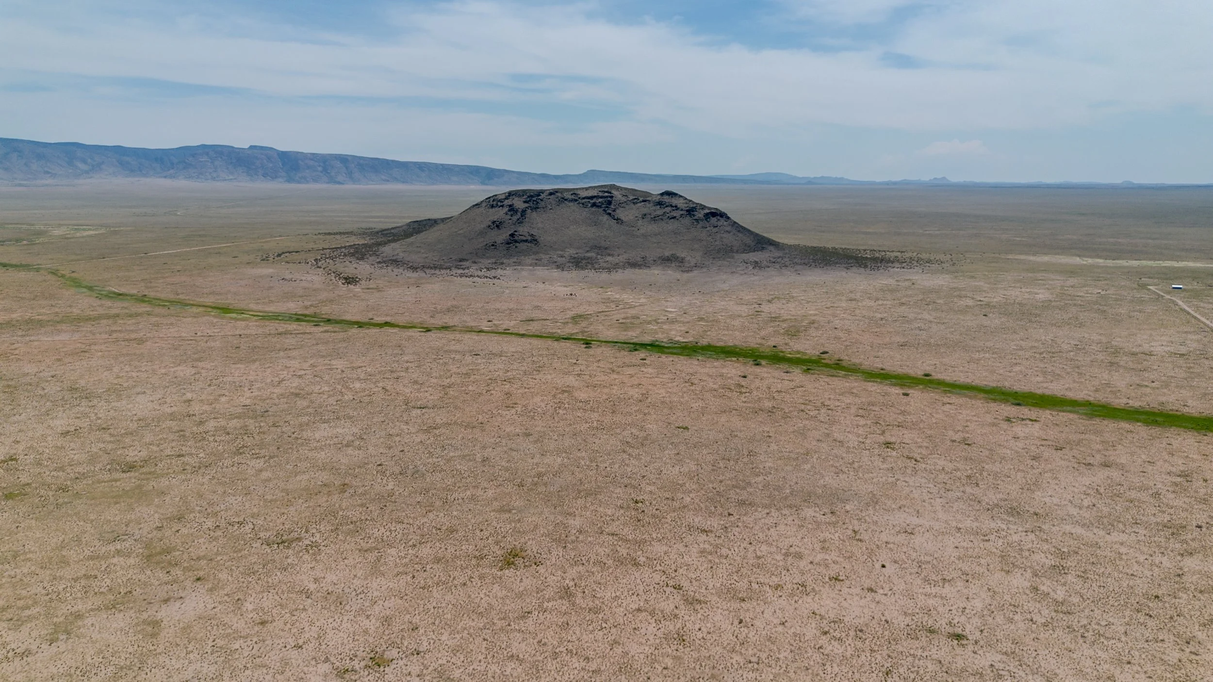
The photo centers on a single hill rising against the landscape, with a narrow green path running alongside it. The simple composition draws attention to the hill’s form and the natural pathway that leads the eye through the scene.
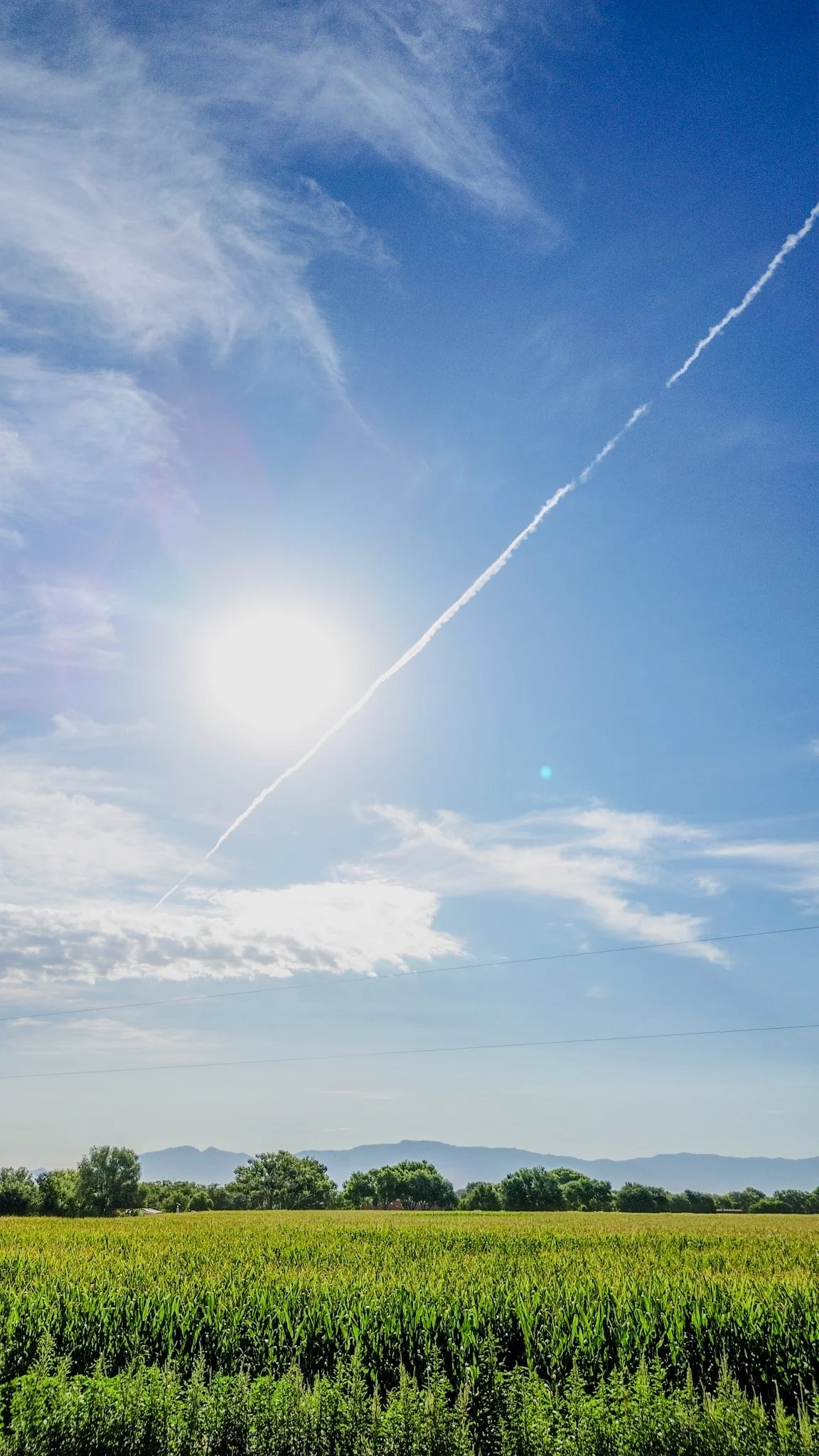
The image shows a cornfield stretching across the foreground, with rows of tall corn under an open sky. A thin white jet streak is visible above, adding contrast to the otherwise calm agricultural landscape.
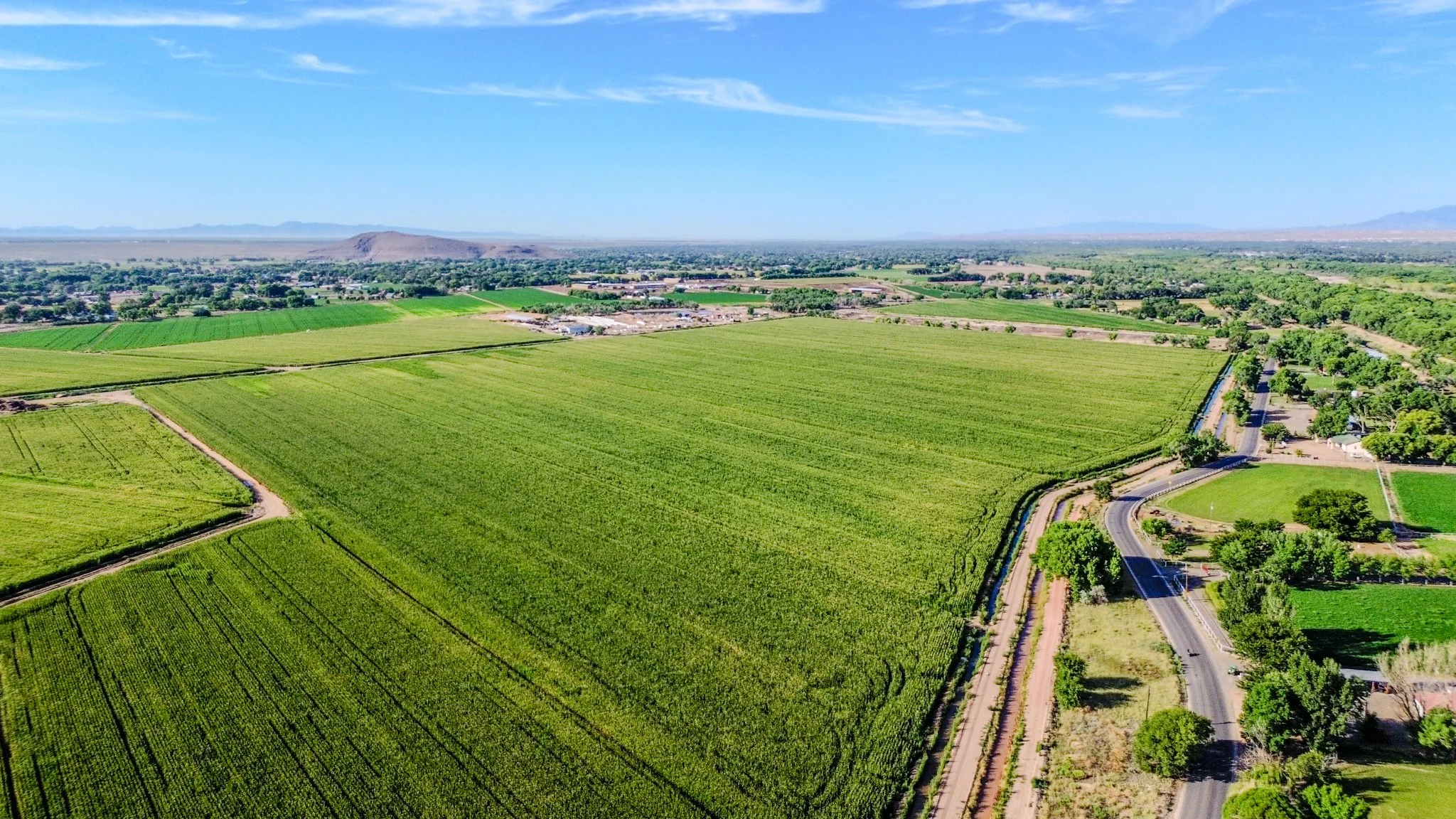
The photo features a wide view of a cornfield, where the rows of corn create strong symmetry and repeating patterns. The alignment of the stalks forms geometric shapes and abstract textures, giving the landscape a unique visual rhythm.
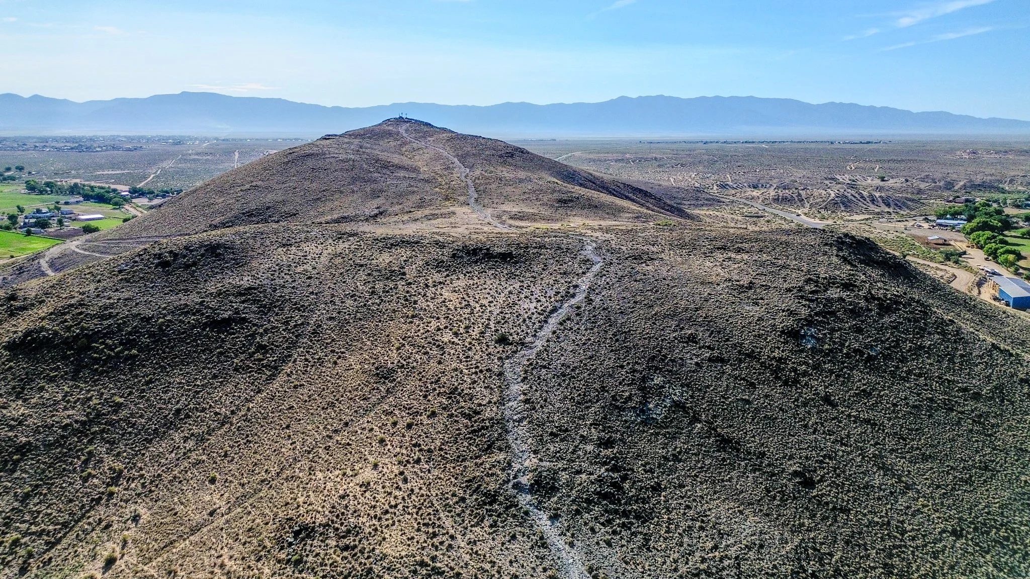
A winding trail stretches from the foreground all the way up Tomé Hill (El Cerro de Tomé), framed by dry grasses and rugged terrain. The path’s switchbacks draw the eye upward toward the summit, where several crosses stand against the sky, and beyond them, distant ranges suggest the Rio Grande floodplain and eastern ridges of the Sandia and Manzano mountains. The scene evokes a journey—steep, natural, and full of quiet purpose.
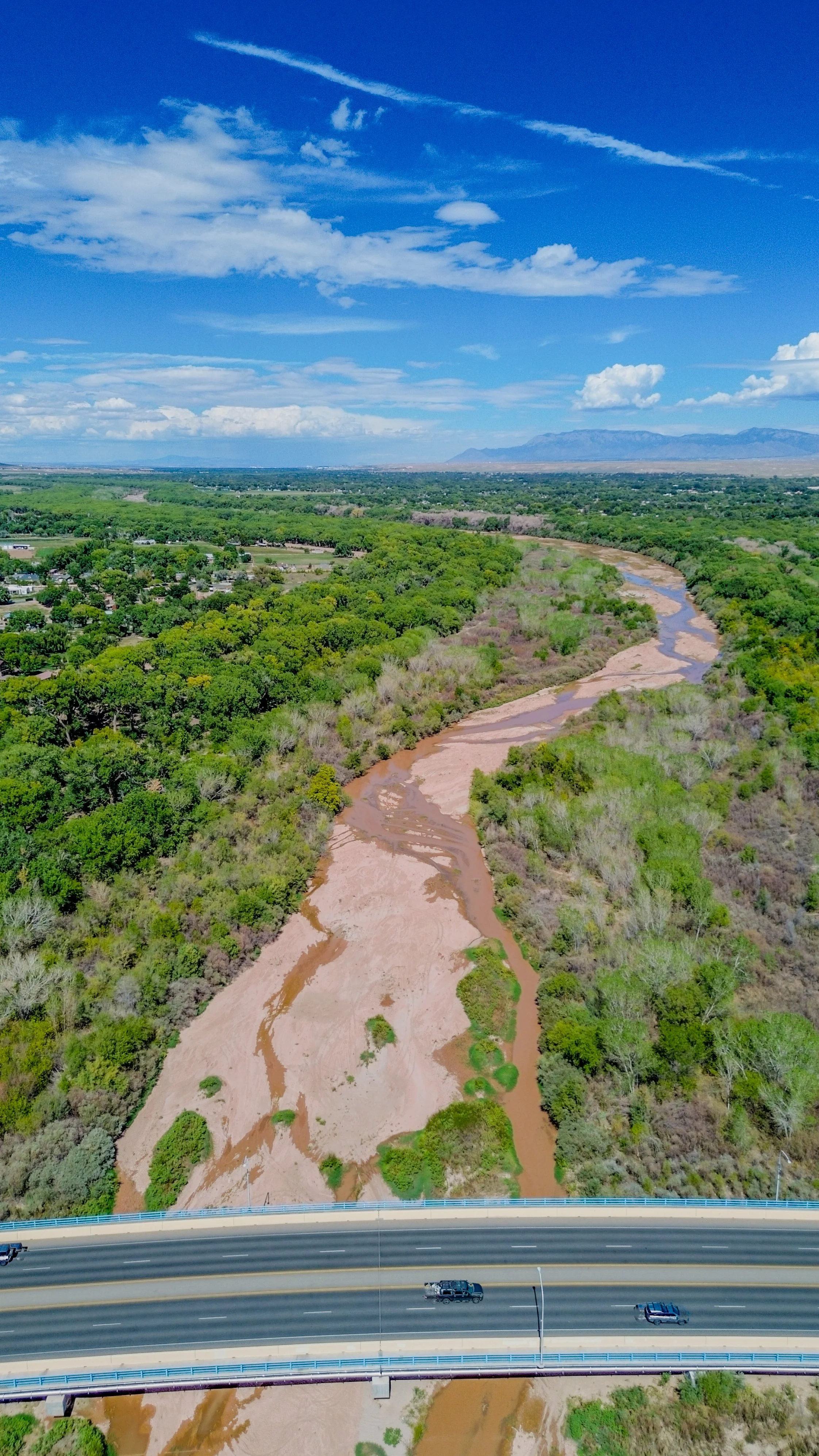
The image features the Main Street Bridge in Los Lunas, with its structure stretching across the frame. In the background, the Rio Grande River is visible, adding depth and context to the scene as it winds through the surrounding landscape.